WESR Geospatial data and services
Pollution Geospatial DataPublication of geospatial in-situ data on sustainable consumption and production and on climate change. Contact: UNEP/GRID-Geneva |
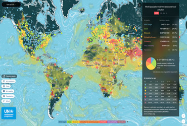
Air visual
Contact: UNEP |
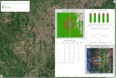
Monitoring land cover change in DR Congo using the Open Data Cube technology, based on Sentinel-2 imagesLand cover changes were monitored using the Vegetation Fractional Cover (VFC) that estimates the fractions of Photosynthetic Vegetation (green vegetation), Non-Photosynthetic Vegetation (mining areas) and Bare Soil (urban area) for each pixel. Results of the analysis allow quantifying the evolution of the surface exploited by the mines, the gain or loss of vegetation and urban development. Contact: UNEP/GRID-Geneva |
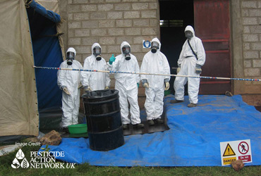
Minamata Convention on MercuryThis MapX geospatial workspace focuses on the Minamata Convention to protect human health and the environment from anthropogenic emissions and releases of mercury. It shows various geospatial layers, dashboards and story maps and includes case studies featuring the use of Remote Sensing tools to support the monitoring of the environmental impacts of artisanal and small-scale gold mining (ASGM). Contact: UNEP/GRID-Geneva |
African Chemicals ObservatoryThis MapX workspace features the Chemicals Observatory project that aims at addressing the necessary improvements to be made in the fields of awareness, knowledge, information management and communication on the sound management of chemicals in Africa. As of November 2021 the observatory has been piloted in 9 countries in applying evidence-based decision making to policy and reporting. Contact: UNEP/GRID-Geneva |
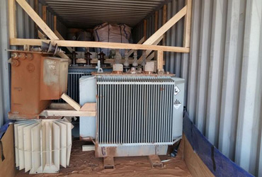
Persistent organic pollutantsThis MapX geospatial workspace focuses on the Stockholm Convention to protect health and the environment from the adverse effects of persistent organic pollutants (POPs). It shows various geospatial layers and dashboards and includes polychlorinated biphenyl (PCB) inventories at the global, regional (West Africa) and national (Togo) levels. Contact: UNEP/GRID-Geneva |
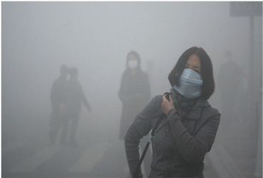
WESR-Air and Water QualityThis MapX geospatial workspace focuses on air and water quality in selected African cities: Addis-Ababa, Cape Town and Nairobi. Air quality data is streamed in near real-time from the cities infrastructure. Water data is derived from the GEMStat database. Contact: UNEP/GRID-Geneva |
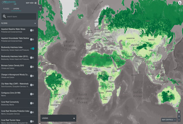
UN Biodiversity Lab
|
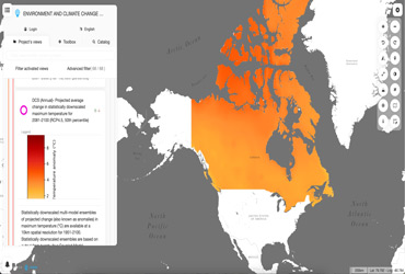
Environment and Climate Change in CanadaThis MapX geospatial workspace focuses on climatic in-situ data in Canada. Developed in the frame of a collaboration between UNEP/GRID-Geneva and the Group on Earth Observations (GEO) it provides access to about 70 datasets, including statistically downscaled scenarios of projected minimum, mean and maximum temperatures. Contact: UNEP/GRID-Geneva |
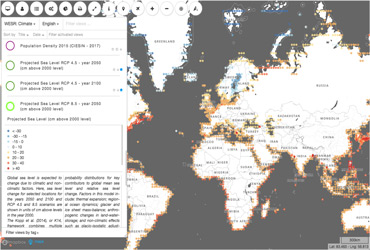
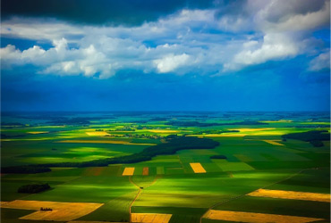
WESR-ClimateThis MapX geospatial workspace focuses on climate change. It shows various geospatial layers classified according to the driver-pressures-state-impact-response (DPSIR) model of intervention. Most layers are at the global level. Contact: UNEP/GRID-Geneva |

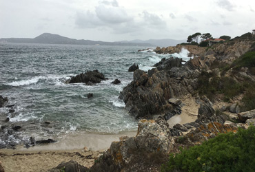
GEMS-OceanKey geospatial data to support GEMS-Ocean, a global environment monitoring system that provides relevant, open, and easily accessible ocean and coastal data, analysis and information, guiding actions to protect and sustainably use marine and coastal resources. Contact: UNEP/GRID-Geneva |
Collaboration between UNEP/GRID-Geneva and the Group on Earth Observations (GEO) on in-situ dataPublication of geospatial in-situ data on sustainable consumption and production and on climate change. Contact: UNEP/GRID-Geneva |
SDG 661
Contact: UNEP |
WESR-MountainsThe aim of WESR-Mountains is to provide all the necessary discoverability and accessibility to existing mountain specific geospatial layers, information and knowledge for better addressing sustainable mountain development issues. Contact: UNEP/GRID-Geneva |
MapXMapX is an open geospatial platform to manage, analyze and visualize data on natural resources and the environment. It has been piloted in dozens of countries at various geographical scales, on numerous environmental topics. Contact: UNEP/GRID-Geneva |
WESR-WaterThis MapX geospatial workspace focuses on water resources management. It show various geospatial datasets, mostly at the global level, including global surface water, groundwater resources and change in the extent of water-related ecosystems over time (SDG 6.6.1). Contact: UNEP/GRID-Geneva |
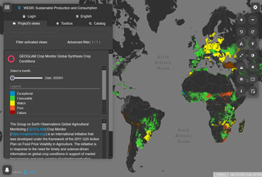
WESR-Sustainable Production and ConsumptionThis MapX geospatial workspace focuses on data about sustainable production and consumption. Contact: UNEP/GRID-Geneva |
WESR-SDGsThis MapX geospatial workspace focuses on the monitoring of Sustainable Development Goal (SDG) indicators such as 6.4.2 (level of water stress), 6.6.1 (change in the extent of water-related ecosystems over time) and 15.3.1 (proportion of land that is degraded over total land area). Contact: UNEP/GRID-Geneva |
WESR-MediterraneanManaged by Plan Bleu (a regional activity center of the UNEP Mediterranean Action Plan) this MapX geospatial workspace provides access to data, dashboards, story maps and other information relevant to the sustainable management of the Mediterranean Sea and coasts, in the frame of the Barcelona Convention. Contact: Plan Bleu |
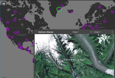
WESR AtlasUNEP Hotspots - A simple method to swipe between two images in a dashboard. The images urls are provided by the data object from a click event on the vector layer. Contact: UNEP/GRID-Geneva |
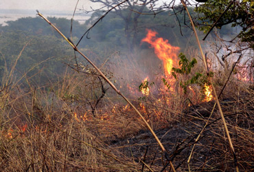
WESR-RiskThis MapX geospatial workspace focuses on natural risks. It shows various geospatial layers, mostly at the global level, and includes frequency/exposure/risk datasets on fires, volcanoes, tsunamis, floods, landslides, earthquakes, tropical cyclones, and multi-hazards. Contact: UNEP/GRID-Geneva |